Saturday, October 1

Some Links for City Research

Useful Links:

New York City Census FactFinder
2000 Census Profiles for New York City (BY STREET ADDRESS/COMMUNITY DISTRICT)
http://gis.nyc.gov/dcp/pa/Map?hseNumber=250&address=WEST+89+STREET&borough=1&event=PROCESS_TRACT

2010 Census: Tables, Maps, and Census Briefs provide detailed information from the PL 94-171 file from the 2010 Census.
http://www.nyc.gov/html/dcp/html/census/census_2010.shtml

MyCITI: the City’s newest mapping resource NYCityMap 
http://www.myciti.mas.org/make_a_map_citi2.html

311 Online Service Request Map
http://www.nyc.gov/apps/311srmap/

Wednesday, September 28

pepper spray

http://www.flickr.com/photos/10749767@N00/sets/72157627619699373/show/

http://www.thirteen.org/metrofocus/news/2011/09/observations-of-a-jailed-journalist/#.ToHsrxu2VfU.facebook

http://www.nytimes.com/2011/09/28/nyregion/a-burst-of-pepper-spray-like-a-punch-in-the-face.html?_r=1&ref=nyregion


http://www.nypost.com/p/news/opinion/editorials/downtown_pep_per_rally_sRew6niv9kd6T1EGBM76eO#ixzz1ZF9KZ2Qj

Video Tutorials


Lynda.com is essentially a site of video tutorials. It's a paid site and members have access to all the videos. However, they also have a good selection of free videos that will at least get you started. I would recommend looking at editing in Final Cut Pro and in iMovie.

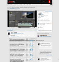
Another great site filled with video tutorials is Adobe TV. You can learn Premiere Pro or you could also give After Effects a go (the software I used to create the community board video). I've linked the tutorials for the latest versions (since school has the latest versions), but you can also find tutorials for older versions of the software on Adobe TV too.

Final Cut Pro X is Apple's latest version of Final Cut. You can get a free trial of this and the Adobe software for a month if you're interested in working at home. The recommended tutorial sites from Apple for Final Cut are: Mac Pro Video and Ripple Training.

EDIT /////////////

Turns out that Mac Pro Video and Ripple Training both allow limited previews but cost money to view the whole tutorials so I did some more hunting for free introductory videos: see below.

Apple actually has an entire host of iMovie tutorials and lessons online that are easy to understand and follow. Just click a lesson and there are video tutorials as well as written instructions.

This site (Izzy Video) has a good list of videos. 

And here's one of a list of videos from Lynda.com teaching Final Cut. (Click link below to go through.)

Initial setup
Final Cut Studio Overview | by Damian Allen

View this entire Final Cut Studio course and more in the lynda.com Online Training Library®.

Watts Street Commuter Bus Problem


According to the Port Authority, between five o’clock and six o’clock PM, 2.8% of the vehicles in the Holland Tunnel carry 48% of the passengers.
Two blocks north of Canal Street, these large Jersey-bound commuter buses drive north on Sixth Avenue and make a left onto Watts before entering the two-lane tunnel.
According to Community Board member Tobi Bergman, this is a problem. The left turn onto Watts street from Sixth Avenue is greater than ninety degrees. Commuter bus drivers attempting this turn have, according the doorman of the Hampton Inn on this corner, have a fifty percent chance of doing so. Buses block three lanes of traffic and endanger the pedestrians, hotel patrons, and children from nearby schools. During rush hour, foot traffic is especially high due to the proximity of multiple subway stations nearby. The three apartment complexes along the North side of Watts also pose a problem, as residents in the second floor standing at their windows are less than ten feet from the buses.
As these buses continue eastbound on Watts street, they are given lowest priority crossing Varick Street. According to Bergman, an average of eight to twelve vehicles sit in between each bus.
In a joint meeting on September 21st, 2011 between Manhattan’s Community Board 1, Community Board 2, and a representative from the Department of Transportation, a special committee voted to submit a resolution to further study the traffic patterns of this problematic area.
Bergman, a transportation improvement advocate for many years, has been proposing the city study this problem since Hudson Street was blocked off for buses ten years ago after September 11th. He proposed a resolution that would submit a request for a formal report from the DOT as to whether or not a designated bus route would solve the safety and pollution caused by the buses sitting idlly
His hope is that the DOT will recommend a designated bus lane on Canal. “From strictly a logistic point of view, the sweep onto Canal from 6th Ave is far less degrees than that onto Watts,” said Bergman.
He believes that this would not only lessen congestion going into the tunnel, but that it would also make it safer for residents and pedestrians along Watts. During the meeting, there was a consensus that Canal Street’s lack of residents makes it a logical solution, but that no vote would be had until the report came back.  
  “Creating a bus lane all the way into the tunnel would also encourage the use of public transportation, which should have already been established city policy.  Community Board Two prefers a bus route that keeps buses on wider commercial streets,” said Bergman during the meeting.
Currently, buses end up in the right lane of the Holland Tunnel because of the difficulty in crossing Varick. But trucks coming from Canal Street end up in the left lane, increasing the chances of two large vehicles running side by side in a tunnel not wide enough for such to be safe. As drivers of the buses and trucks attempt to maneuver narrow lanes, traffic is further slowed.
“I am not asking for implementation, but for an evaluation. Now is opportune with the newest toll hikes, which has drastically changed the traffic dynamic. We are not trying to move the problem from one street to another,” said Bergman.
When asked whether this was really going to solve the problem of congestion, Bergman replied, “Traffic is what traffic is. There’s no promise to lessen traffic, but let’s just get the buses safely through.”


Monday, September 26

Pepper Spray Follow Up

Found this follow up to the Occupy Wall Street pepper spray incident on The Daily What. Also learned that the NYPD officer has been identified. Below, Chelsea Elliott, 25, tells her story. You can also read the Village Voice's interview with her.


Interview with Pepper Sprayed Protester Chelsea Elliott from ANIMALnewyork.com on Vimeo.

links of the day

http://nyulocal.com/on-campus/2011/09/21/nyu-2031-nyus-governors-island-fantasy-is-faltering/

http://www.nytimes.com/2011/09/25/nyregion/kcdc-where-skateboarders-can-shop-and-defy-gravity.html?ref=nyregion

http://www.huffingtonpost.com/2011/09/23/ap-keeps-investigating-nypd-spying_n_978128.html

http://www.nytimes.com/2011/09/26/nyregion/in-a-manhattan-park-a-question-of-law-and-a-jewish-symbol.html?_r=1&ref=nyregion


http://www.nytimes.com/2011/09/25/nyregion/protesters-are-gunning-for-wall-street-with-faulty-aim.html?ref=giniabellafante


http://www.nytimes.com/2011/09/26/nyregion/kirsten-john-foy-city-aide-emerges-as-advocate-for-racial-justice.html?ref=nyregion


http://www.newschool.edu/milano/nycaffairs/?s=1:6

Links of the Week by Lauren Valenti

"Videos Show Police Using Pepper Spray at Protest"
By Joseph Goldstein for the New York Times


"Wired Platforms at Last. Oh No, the Boss Is Calling!"
by Rebecca White for the New York Times


"Sly Stone is Homeless in Los Angeles"
by Matthew Perpetua for Rolling Stone Magazine


New York Magazine Approval Matrix for Week of October 3rd, 2011


"Paul McCartney, Beatle and Ballet Composer, too"
By Jocelyn Noveck for the San Francisco Chronicle


Bushwick CB4


Bushwick sits in Brooklyn’s 4th community board, or CB4. “The areas now called Williamsburg, Greenpoint and Bushwick were originally one Dutch settlement, the Town of Bushwick.” Since separated, the Bushwick boundaries are now defined by Flushing Avenue to the west, down along the “odd-numbered side” of Broadway until the Eastern Parkway extension. Then the Brooklyn/Queens borough line provides the final side.

Bushwick is still remembered for the destruction that took place within its borders during the 1977 blackouts, with hundreds of stores burned and looted while other shop owners protected their businesses violently. An arson fire – reportedly the second worst fire in New York history – also spread destroying four block and forty-five homes. Since then the population diminished drastically. Figures show that in 1970 there were approximately 138,000 people living in Bushwick, in ’75 that number had decreased to 122,000 and the dropped further to 93,000 by 1980. However, by 2007 the population had increased to 129,980, still less than the population’s original strength.

With 38.9 percent of the Bushwick population foreign born, the neighborhood struggles financially. The seventh most impoverished neighborhood in the city, the approximate household income is around $28,800. In 2007 Bushwick averaged 25 felonies per 1000 persons, making it the 25th most felonious community district in New York City.

However, in the past ten years steps have been made towards restoring Bushwick in the form of government-funded revitalization projects. Between housing improvements as well as revitalization projects within the neighborhood parks, and the comparatively low rent, Bushwick has seen a recent upsurge in population. Commercial development incentives have recently brought in new stores and restaurants and a recent population increase to support them. Thus Bushwick residents have high hopes for a full-scale resurgence.

Manhattan Community Board #3

            Community Board 3 in Manhattan is located in the East Village and Lower East Side and meets many times a month to discuss issues surrounding their neighborhoods.  However the issue of disruptions in quality life due to a high concentration of establishments with liquor licenses in this area has been visited more than others.
            Most recently, members of the Community Board have suggested designated areas for nightlife, or “no-go” zones.  Although the concept is abstract, residents worry that the impact of underutilized private space and gentrification has triggered a robust community response to noise. 
            “Within these ‘no-go’ entertainment zones,” explains Kirsten Demaline, a member of the Community Board 3, “it is assumed that police have an increasing challenge in maintaining order and protecting residential interests I term of quality of life or property protection.”
            NYPD misdemeanor-level data taken from 2007-2010 demonstrates certain patterns from the three precincts within this community district: the 5th, 7th, and 9th precincts. 
1.     Disorderly Conduct:  This is a violation beneath the level of a criminal misdemeanor.  Most likely the violator will be charged a nominal fine.  The number of summonses that were issued in this category between 2007 and 2010 has had a major increase of 53% in the past four years.


2.     Public Urination “C” Summonses:  Public urination has been an issue for the members of the board for many years.  However in the past four years, the number of violators has risen 26%
3.     DWI Arrests:  The number of DWI arrests has decreased by 4% in District 3 but has increased in a number of the surrounding districts.  The worst, is the increase in district 9 at 203%.  In an effort to decrease this number, members have suggested checkpoints or another implement for west side drivers leaving the nightlife district.

“In the 9th precinct, the number of summons issued for misdemeanors actually increased to a large extent across the board through 2010,” Demaline offered, however, “this does not necessarily indicate the levels of offensive behavior have increased… enforcement changed could also bolster numbers.”
Members have been actively involved in trying to create solutions to these problems, but haven’t found a plan that could work.


Source for Data and Photos:


"Improvements" for Bushwick are Questioned


Bushwick, NY- Mixed opinions rose after a power point presentation kicked off the first meeting of Community Board #4, the board for Bushwick in Brooklyn. After a two-month vacation, the Community Board came together on Wednesday September 21st at 6:00pm for the first time since June. The meeting was held at Hope Gardens Multi-Service Center on Linden St. at the corner of Wilson Avenue. The board's chairwoman, Ms. Julie Dent, led the meeting along with 33 board members and a crowd of approximately 40 people from the public, a slim crowd compared to the over 100 that attended the Community Board #2 in Manhattan.

Community board at #4*

Representatives of the Department of Design and Construction presented one of their new projects concerning school safety improvements. This is a citywide project adding up to a total project cost of $2,883,365, according to their website.Construction is planned to begin in the Fall of 2011 and completed in the Spring of 2012. The DDC's city project will include the implementation of ramps at schools, trees and street lights. The project proposed to the Bushwick community specifically, would be to expand 8 intersections near throughout Brooklyn, the intersections are in the vicinity of schools and will create a better field of vision from the driver’s point of view.

Left: Expanded sidewalk at intersection

The DDC representative said, “The intersections will create the illusion of the road getting smaller,” he added added, “so most of the cars will want to slow down.”

Studies conducted in 1998 proved that there was an annual total of 400 pedestrian fatalities, which is more than a 10% increase from the pedestrian fatalities in 2010 according to the New York Pedestrian Safety Study and Action Plan. According to the presentation, the DDC conducted studies at several intersections around grade schools in Brooklyn and Queens. And chose the intersections in their similarity to those they chose in Bushwick.

There was a recommendation in favor of the project by a public attendee, John Wright, 54. However, the board, with support from several voices in the community, decided that voting would be suspended after a resident of Bushwick avenue and Putnam street, an intended location for the project, testified. He insisted that since the study had been conducted, stop signals had been erected at the corners.

“We need up to date data.” He said “since the studies they have made adjustments.”

Worries arose over neighborhood disruption during the construction, snow pileup. There were fears that the project would have become obsolete due to studies that were conducted in 1998 at intersections similar, but not the intersections that were described. In response, the DDC insists that the contractor will be responsible for all damages and an outcome of child safety as well as a high percent decrease of pedestrian casualties. However, they are aware of the inconveniences and appreciate those being effected by them according to the DDC's official website.

The DDC already has the money to begin the project and the board must accept or reject the referendum. Vice chairwoman, Ms. Martha Brown, meditated on what the outcome of the project may be and the public’s influence.

“They are already funded.” She said, “they will probably go along with it, however,” she added, “if the community feels strong enough they can make a difference.” The decision will be made Tuesday September 27th in the same location.

*http://www.maps.luventicus.org/newyork.html

JUMP! JUMP! JUMP!

            Peaceful demonstrations in lower Manhattan turned violent over the weekend, most notably when NYPD officers attacked a small group of female protesters with pepper-spray, temporarily blinding two. 
The Police Department’s chief spokesman, Paul J. Browne, however, said the police used the pepper spray “appropriately.” (source: NY Times).
Videos of the incident and videos like it are fueling public interest and providing for it the publicity it needed to become nationally recognized.
            “I hadn’t even heard about it until this weekend when The [New York] Times covered it,” said Carmen Melo, daily Manhattan commuter.  “The videos that I’ve seen are utterly shocking.”
            Unlike most organized protests, the occupation of Wall Street is unique in that it is without specific demands. 
            “Our goal is to expose the inequalities of the American financial system by exposing ourselves,” said Mitchell Mora, disgruntled Lang student.   
            There is shared sentiment among organizers that Wall Street folk are not taking the peaceful protests seriously enough.  On Friday, Mora recalls workers toasting the crowd from their fourth floor offices.  This gesture was followed with outrage from the crowd, which screamed, “Jump! Jump! Jump!” to the mocking silhouettes above. 
            Mora believes that the demonstrations are just beginning and that more of the “99%” need to get involved, specifically the New York student population.  Mora became aware of the occupation at The New School when he saw a student-made flier advertising the event (the flyer was unaffiliated with The New School and its organizations).
“I think it’s relevant for New School students to participate,” said Mora.   “Anyone who cars for social justice should be taking this personally and very seriously.  All we’ve experienced so far is mocking disrespect.”
            While New Yorkers are beginning to pay more attention to what is happening downtown, the nation is also beginning to take note as similar protests are taking place in other major US financial centers.
            “We know people are starting to organize in Seattle and all the West Coast,” said Mora.  “We are secure in our purpose and confident that others will understand our disposition.”

Brooklyn community board 1

District 1 shown in orange, illustration courtesy of luventicus.org

Brooklyn’s community district 1 encompasses Williamsburg and Greenpoint, two neighborhoods in the middle of tumultuous changes. The area, which has been the frontier of New York’s gentrification in the last couple of decades, had 142,942 residents in 1980 and 160,338 in 2000. The latter was the latest reported number, leaving one to wonder exactly how many new residents have arrived within the last eleven years. The area has served as a jumping ground to local artists for decades but has lately made headlines when residents complain the neighborhood is losing its originality.

The community board for district 1 meets monthly to discuss plans, ideas and problems concerning the area. The fairly young average age of the district’s residents – 30 percent of them are between the ages of 25 and 44 - is reflected on the issues brought up in the meetings. In April’s meeting, for example, over forty bars and restaurant applied for liquor licenses and renewals. Other issues included requests to open a martial arts club, a sidewalk cafĂ© and a taxi service. The latter was presented to the board by David Yassky, chairman of the Taxi and Limousine Commission, who claimed that getting a yellow cab in Brooklyn is difficult and forces about 150,000 people a day to hail down unlicensed “gypsy cabs”. The solution to the problem, according to Yassky, would be a legitimate taxi service that would provide the neighborhood with marked cars that could be stopped on the go.

Community board 1 has influenced a bigger project as well. In 2005, mayor Bloomberg’s administration approved a rezoning plan concerning the neighborhoods of Williamsburg and Greenpoint. This plan will eventually result in 50 acres of new parkland along the East River, including a 1.6-mile long public esplanade. The community board has had its share of complaints about the changing neighborhoods, and hopes are high for the new waterfront plans. According to the waterfront master plan, the changes are intended to “create a balance between active and passive recreation opportunities to serve the diverse recreation needs of the community.” The vision, which was developed with the help of the community board 1 and is a significant step in the ongoing gentrification of the area, will undoubtedly prove to be a much-discussed topic in the years to come.

Illustration of the upcoming Greenpoint-Williamsburg waterfront, by Donna Walcavage

Brooklyn Community Board 4


(image courtesy of nyc.gov)

Brooklyn Community Board 4 encompasses the neighborhood of Bushwick. The land area is 1,311.2 acres with its boundaries running from Flushing Avenue to Conway Street, the odd numbered side of Broadway, the Eastern Parkway extension, and the Brooklyn-Queens borough line.


The Community Board 4 office is located at 315 Wyckoff Avenue on the 2nd floor. Its primary functions are to process resident's complaints and request for services and to provide the Community Board with administrative support.


As of the 2000 United States Census, Community Board 4 has a population of 104,358, primarily made up of Hispanics (67.2%). As a result, many businesses cater to Hispanic residents, like this Mexican bakery and grocery store. The rest of the population is made up of African-Americans (23.8%), Asian or Pacific Islander (3.1%), non-Hispanic Whites (2.9%), American Indian or Native Alaskan (0.3%), two or more races (1.9%), and some other race (0.8%).


In 2008, the average housing income was $28,802, with 32% falling under the poverty line, making Bushwick the 7th most impoverished neighborhood in New York City.


Community board meetings are held at Hope Gardens Community Center at 195 Linden Street on the corner of Wilson Avenue. The meetings are often concerning land use and zoning matters, the city's budget, and municipal service delivery.


The Community Board also deals with matters relating to the welfare of the community, including but not limited to traffic problems, missing or damaged signs, and malfunctioning street lights.

Brooklyn Community Board 8


Brooklyn Community Board 8 represents the neighborhoods of North Crown Heights, Prospect Heights, and Weeksville.  Atlantic Avenue serves as the northern boundary for the board, Eastern Parkway denotes the southern boundary, Ralph Avenue is the eastern boundary and Flatbush Avenue is the western boundary (refer to the map above). The community board serves as the direct link between the neighborhoods and the city government by becoming a place to gather response, make decisions, monitor land use, municipal services, city budget and bring awareness to any other neighborhood issues.

As of 2006 the total population within the bounds of Brooklyn Community Board was 127,013, with the median annual income being $38,524. The population is comprised by the majority (74%) being Non-Hispanic Blacks, followed then by Non-Hispanic whites (13%), Hispanics (10%), Non-Hispanic Asians (2%) and the remaining 2% of the population identifying themselves as another race or ethnicity. Of the total population 81% of individuals fall between the ages of 18-54, the remaining 18% is 55 years old or older. As of 2010, 46,994 residents (about 37.3% of the total population) receive income assistance in varying forms, the majority in the form of Medicaid.

The community board is comprised of 50 unsalaried members, half whom are appointed by the borough president and the other half who are appointed by local city council members; members of the board must live in, work in or show a strong interest in the Community Board 8 domain. Along with serving as a forum for discussion surrounding services and neighborhood concerns the board has an extensive compilation of resources, the lot of which can be accessed through their website. Information regarding local schools, churches, health services, continuing education opportunities and childcare services are all compiled here; community friendly events and services as will as updates about construction or road closures are also topics the board posts to their website.

Brooklyn Community Board 8 holds a monthly general meeting, as will as multiple committee specific meetings, all of which are open to the general public. Meeting schedules and locations can be found on there website here.


 *Population statics sourced from NewYork City Department of City Planning


Manhattan Community Board #6


“Manhattan Community Board 6 is active in maintaining and improving the quality of life of area residents by closely monitoring municipal service delivery throughout our district.”
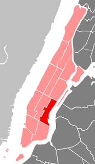
A map illustrating Community Board #6,
courtesy of Wikipedia.

Manhattan Community Board 6 is comprised of neighborhoods located along the East Side of the island, ranging from 14th to 59th street. Neighborhoods in Community Board 6 include Gramercy Park, Turtle Bay, Stuyvesant Town, Peter Cooper Village, and Murray Hill. The area of Board 6 is roughly 1.4 miles, or 888.4 acres, according to the city’s website. Community Board 6 is also home to the United Nations, many embassies, and the homes to numerous foreign diplomats.

According to the New York City website, the population is over 136,000 as of the year 2000, a %1.8 change from the 1990’s census. The population is over %75 Caucasian, with Asian/Pacific Islanders making up %10 of the population. There has been a %45 increase of Asian/Pacific Islanders in the area from 1990-2000, a trend that attributes to the increased Asian influence throughout the Community Board.

The average household income in Community Board 6 is over $73,000, with a fairly low rate of families below the poverty line, far below the New York City average. Over %31 of the employed work in the areas of Management, Business, and Financial Operations, much higher than the New York City average of %13.5. All of this information was according to the New York City community board website.

The Community Board #6 is also home to five hospitals, including the NYU Lagone Medical Center and the Beth Israel Hospital. In addition to all of the typical committees that a Community Board would have, such as Budget & Governmental Affairs, Business and Street Affairs, and a Parks and Landmarks Division, the #6 board also has a Land Use and Waterfront committee, which has a specific subcommittee that works with the waterfront along the East River, which serves as a boarder to the east.